Urban exploration - The ghost village of Doel
This short photographic report focuses on the unoccupied village of Doel, located in the municipality of Beveren, northwest of Antwerp, Belgium. Contrary to common reports, it is not an "abandoned village" in the same sense as those found in Spain or Italy. The streets are maintained by municipal workers from Beveren, a town of nearly 50,000 inhabitants. The village is largely unoccupied due to numerous expropriations intended to make room for the northward expansion of the Port of Antwerp - and not, as is often claimed, because of the nearby Doel nuclear power plant. Due to sluggish economic trends and incessant legal hurdles, this port expansion project is currently stalled or facing significant difficulties.
Strategic Location and Industrial Expansion
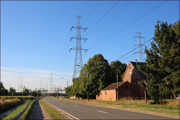
Doel is situated in northern Belgium on the banks of the Scheldt river, on the border with the Netherlands. Its location is strategic; positioned opposite Lillo, Doel lies directly within the expansion zone of the Port of Antwerp, a major industrial site. On the right bank, the port extends continuously to Zandvliet.
The expansion of the right bank resulted in the complete removal of the villages of Lillo, Wilmarsdonk, Oorderen, and Oosterweel.
At one time, it seemed logical to extend the port similarly on the left bank. Thus, Doel - built on ancient polders and marshland and regularly flooded by Scheldt tides until massive dikes were constructed in the 18th century - was slated for expropriation. To the north, the village is bordered by the Verdronken Land van Saeftinghe (the "Drowned Land of Saeftinghe"), a vast area of mudflats in the Netherlands. "Verdronken" means flooded; establishing a port extension here appeared perfectly logical to planners.
The Legend of Doel: An Unique History
The village has a long history defined by water. Before the 18th-century dikes, Doel was accessible only by boat. During a strategic reconstruction, it was laid out in a checkerboard urban grid, a unique feature in Belgium, consisting of three streets parallel to the dike and four perpendicular streets. This layout remains visible today. The village's merchant history is ancient; in 1325, a cog (a merchant ship) was grounded in a nearby dead arm of the Scheldt, only to be discovered recently.
The first major blow to the village came in 1968 with a building ban intended to halt its expansion. This was paused by the oil crisis, and the ban was lifted in 1978. However, in the 1990s, the Deurganckdok project - a tidal basin immediately south of the village - raised fresh concerns. By 1995, administrative plans to demolish the village were made public, sparking a fierce and highly mediatized resistance that began in 1997.
Legal Limbo and "Uninhabitable" Status
In 1999, the Flemish Region declared the village "uninhabitable" (onleefbaar). While some residents welcomed this as a path to fair expropriation, opponents resisted. The sector plan called for Doel to vanish completely by 2020. However, in 2002, the Council of State overturned this decision, legally reverting Doel to its 1978 status as a residential zone. This plunged the village into a period of extreme legal conflict.
While the Deurganckdok opened in 2005, plans for the Saeftinghedok - which would be dug directly where the village stands - remained on the table. Since 1999, residents could choose expropriation, and their homes became the property of Maatschappij Linkeroever (the land management company for the port). Many left, but a core group remained, granted temporary occupancy rights renewed every five years.
A Village of Ghosts and Squatters
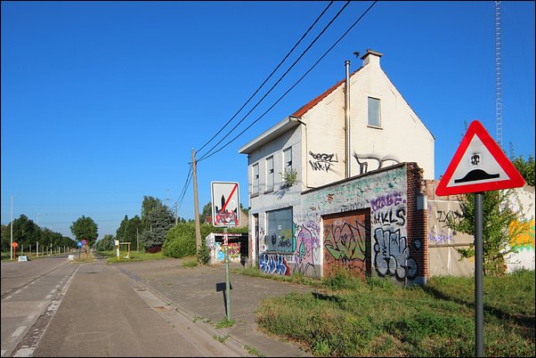
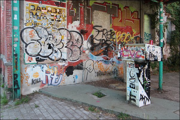
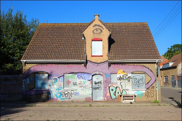
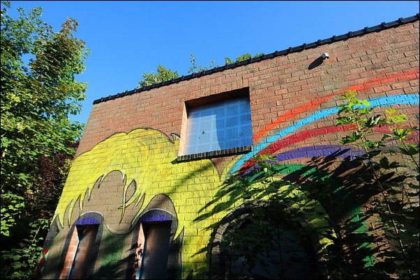
By 2003, only a third of the original population remained, leading to the closure of the village school. The void was filled by an estimated 150 to 200 squatters. While initially tolerated, a rise in crime led to a crackdown. Since then, the situation has been chaotic. In 2007, plans to demolish 40 houses were blocked by a court in Dendermonde.
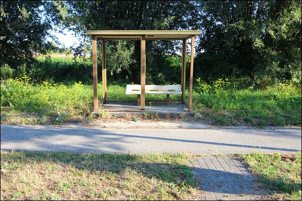
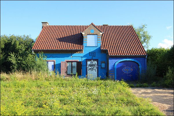
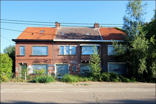
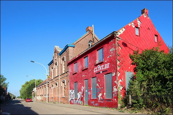
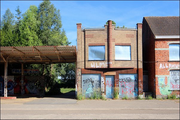
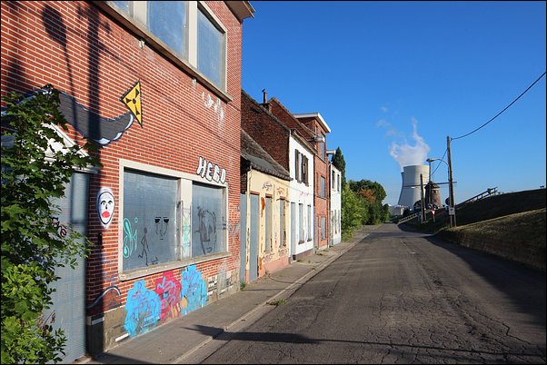
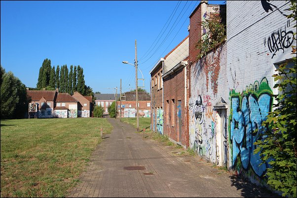
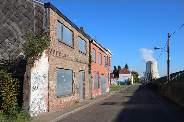
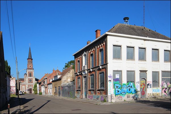
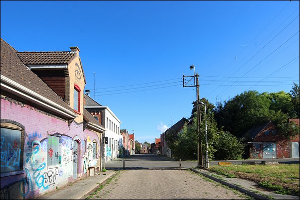
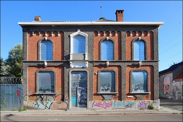
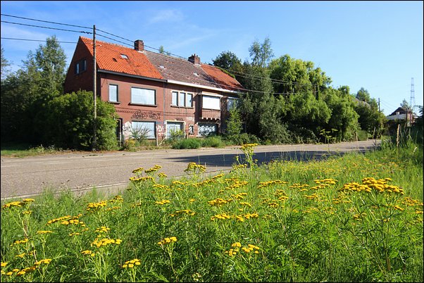
Today, Doel exists in a state of "stalled" decay. Roughly every second house is unoccupied, and almost all are boarded up with stainless steel plates to prevent squatting and fires - a costly measure. Despite the decay, the authorities continue to maintain the streets, as the village is neither fully deserted nor officially demolished. In 2013, plans to raze 300 houses were again challenged; the court ruled that living in a partially demolished environment was an undue nuisance for the remaining residents.
The Current Status-Quo (2018)
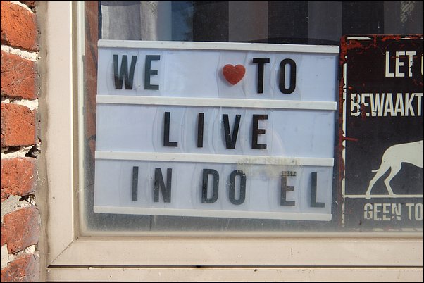
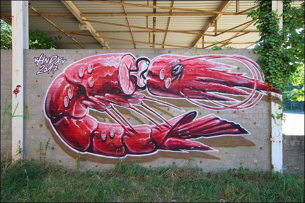
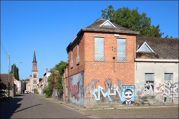
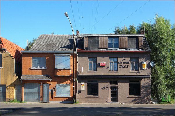
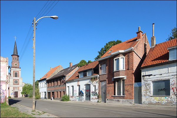
In 2016, defenders won a fragile victory: the village would not be razed, even though 99% of the houses belong to the port authority. Currently, only about 18 residents live in the seven streets targeted for demolition, while the wider area has about 300. In an absurd twist, the church is kept in perfect condition, and a local bar, De Molen, still serves customers amidst a constant stream of "urbex" tourists.
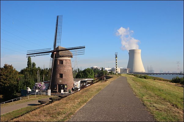
In 2018, Ben Weyts (Minister for Mobility) suggested that the Saeftinghedok might "probably" never be dug. Twenty years of demolition projects have failed, complicated by EU nature directives and water management plans for the Scheldt basin. Furthermore, the Seveso Directive - which restricts industrial projects near nuclear plants - adds another layer of protection.
In June 2018, a new proposal emerged: expanding the Deurganckdok to the south instead of digging the Saeftinghedok over the village. This would spare Doel and end two decades of legal battles and the massive financial drain of maintaining a ghost town. If accepted, the village could be repurposed as a living entity once more.
For now, entering Doel feels strange - like an intruder in a deserted zone. The houses are in very poor condition, and road access is restricted by bollards. The struggle for Doel is far from over, and the few remaining residents are incredibly brave to endure this devastated landscape.