La rivière souterraine
We received photos from a traveler and compiled them into a historical summary.
Voici une traduction naturelle et fluide en anglais :Here's the exploration of an underground river, discovered after a lot of research and quite a few uncertainties. While there was a vague idea that it might exist, the only real clues were the impression that the stream simply disappears when viewed from the air. Honestly, that was it - nothing more.
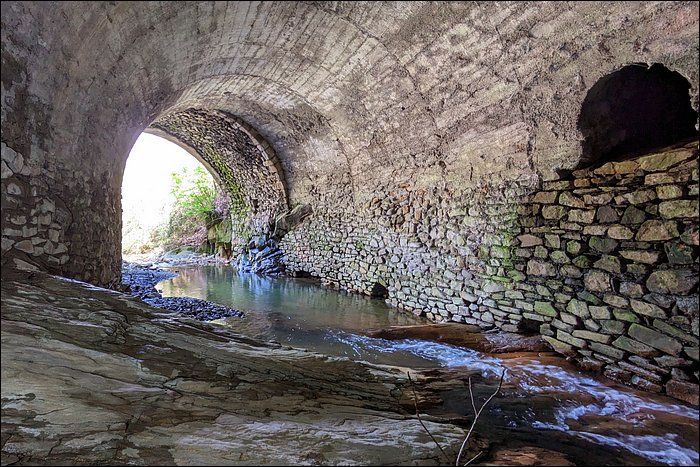
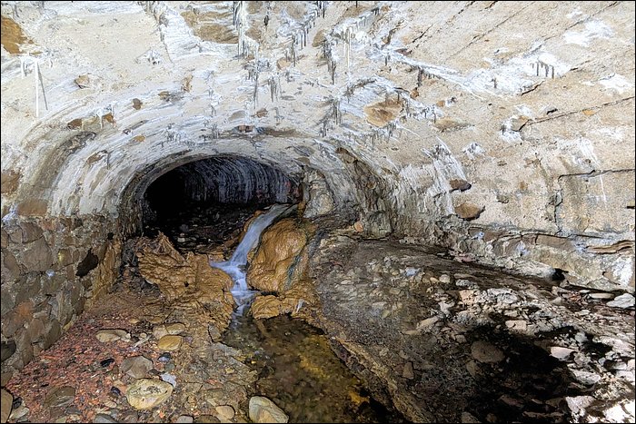
The day is sunny, spring-like, with no risk of storms or heavy rain. So there's only one thing left to do: go check it out.On site, while the little stream does indeed flow into the large river, damn… the entrance is ridiculously low. A quick flash of the torch reveals that this is going to be long - very long - and the spiders are waiting in ambush, somewhat annoyed and, let's say, naturally in a bad mood!
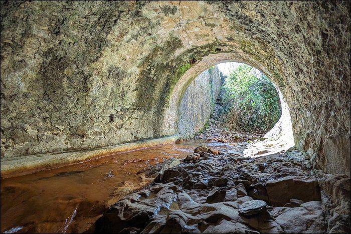
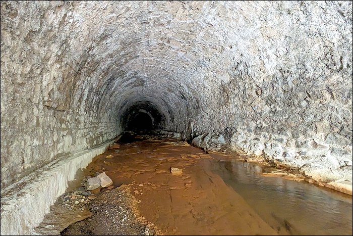
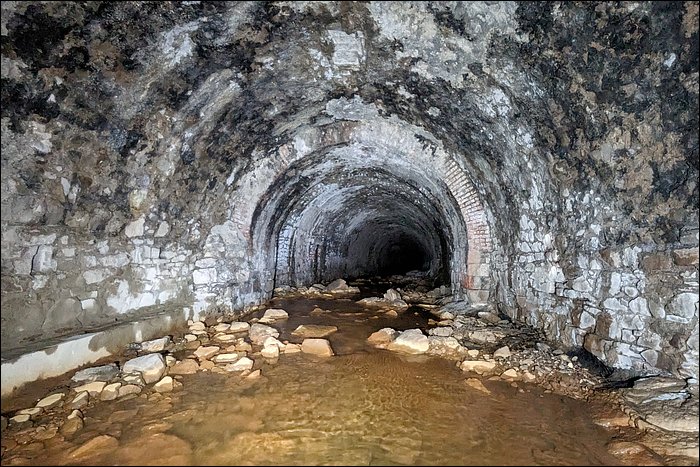
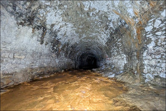
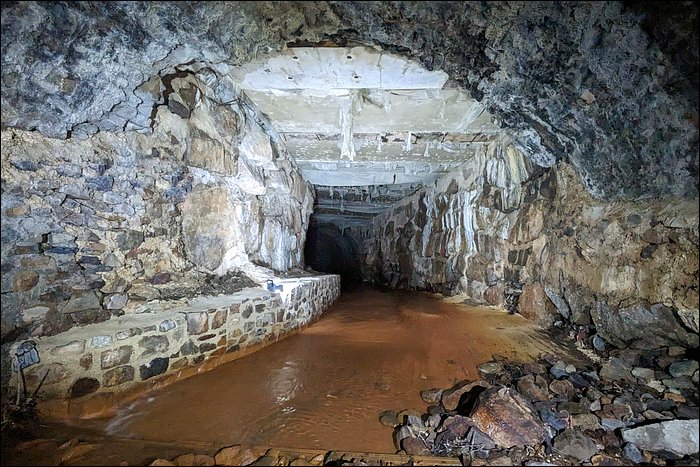
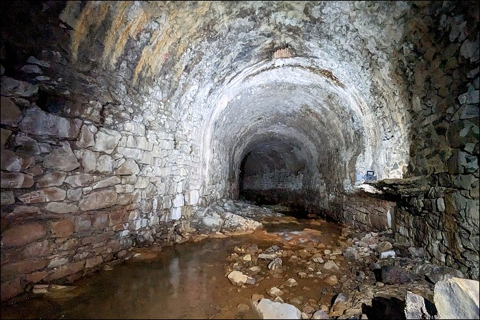
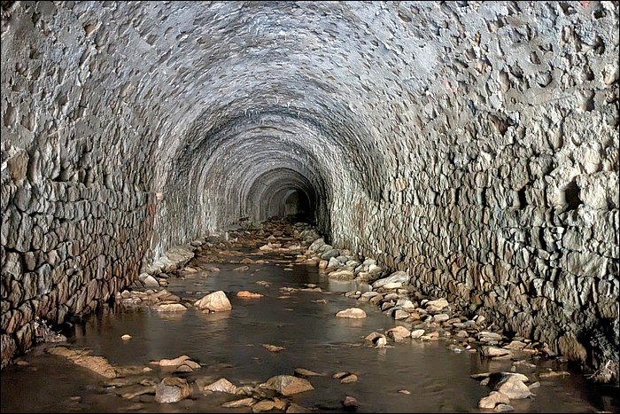
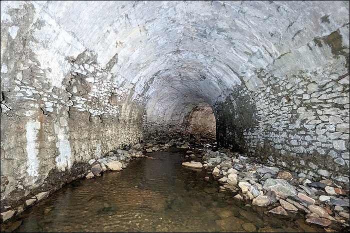
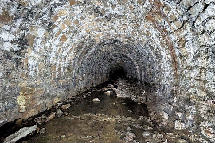
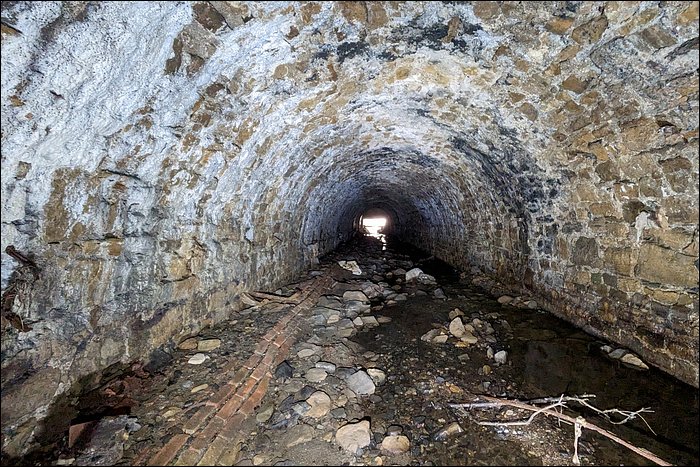
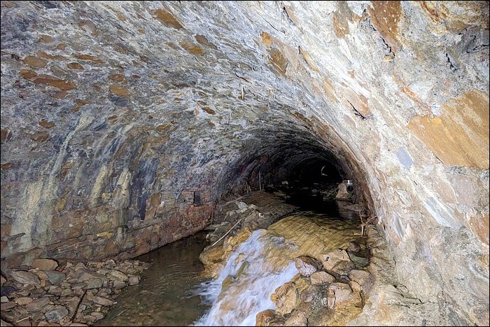
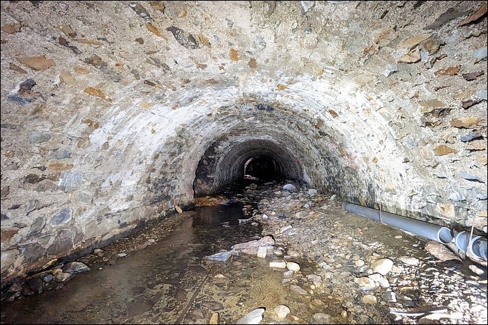
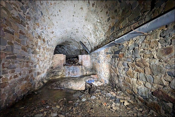
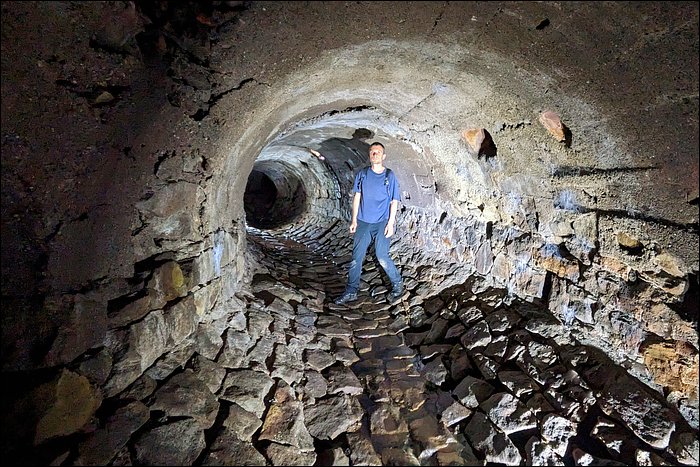
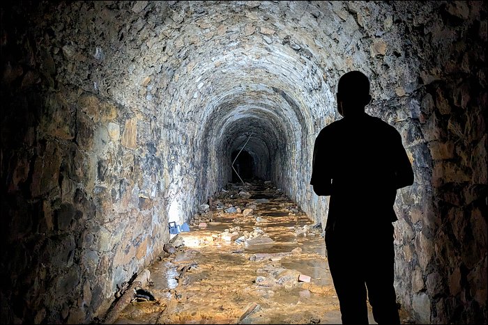
After the low passage, it suddenly opens up and becomes absolutely wonderful.The stream is surprising right from the start because of its length. Man, it's huge! What's more, it splits into many smaller branches, which makes the exploration pure joy.These covered rivers come from the coal mining era. We're in a mountainous region. Right from the beginning, they ran out of flat space to build the mining facilities. So at the end of the 19th century, they created flat areas by vaulting over streams and then filling on top with spoil, waste rock, and soil. In short, it was an enormous amount of work. About ten such covered rivers can be found in the area.After the mine closed, these flat areas were logically reused: football pitches, children's playgrounds, car parks, campsites… perfectly normal. As a result, the underground rivers gradually fell into a kind of oblivion.
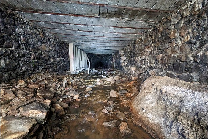
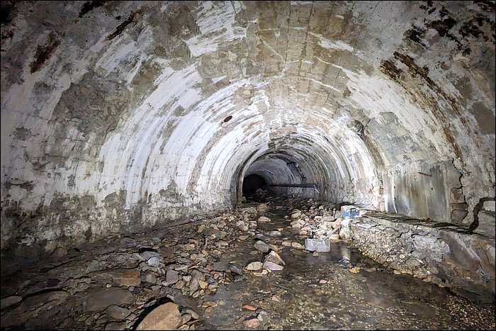
Here we're dealing with a rather low vault, but other covered rivers in the region reach impressive heights: 6 to 8 meters. In recent years, some major collapses have occurred. Huge, gaping holes more than ten meters long caused total panic in the area.The small communities - already weakened by the mine closure - saw their budgets shattered by these disasters. The villages eventually banded together to pool their resources. The galleries have now been fully mapped, modelled in 3D, and their evolution is being monitored. Meanwhile, all the surface communal facilities have been closed and abandoned.
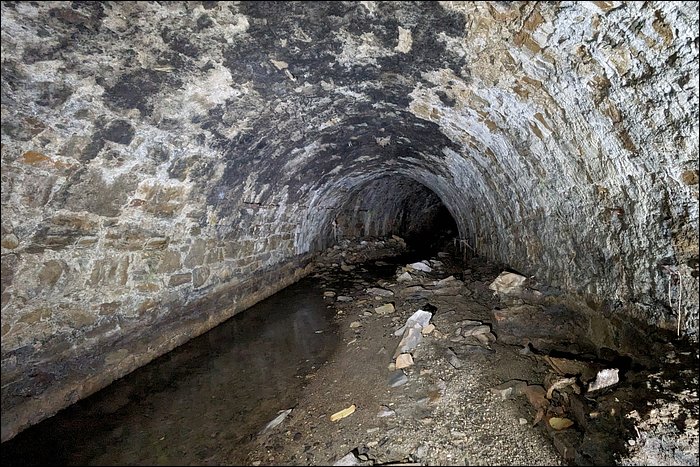
These underground rivers have become a real thorn in the side of the local authorities - and it hurts.So here's a little walk through some branches of this network. The biggest sections couldn't be properly filmed due to lack of light.
Anyway, it was a very pleasant discovery.
I hope you enjoy the journey!
Une seconde rivière souterraine